 While your roles and responsibilities as a senior engineer in today’s fast-paced environment have likely not changed in context, the complexity is an entirely different challenge. Projects are in general, bigger, more costly and, given labor and supply chain challenges, more logistically demanding.
Evaluating the impact and feasibility of sites, preparing budgets and schedules, supporting the planning and design activities, and documenting progress has become more about managing data chaos versus finding optimal solutions to improve delivery and quality of solutions. In many cases, interoperability of applications is more utopic than realistic.
Effective data management, having the right information accessible in a visible and visual format, is essential. That’s where a solution such as OpenRoads can help. From conceptual design to plan production, OpenRoads has all the tools that a senior engineer might need to meet today and tomorrow’s contract requirements.
What is OpenRoads?
OpenRoads comprises OpenRoads ConceptStation and OpenRoads Designer.
OpenRoads ConceptStation leverages data from a variety of sources—traditional surveys, point clouds, 3D reality meshes, terrain data, images, and geospatial information—to help engineers create intelligent 3D conceptual road and bridge models in a real-world setting in a matter of hours. It’s a purpose-built tool to generate project estimates and identify potential risks early on.
OpenRoads Designer is a multi-discipline 3D modeling application that blends traditional engineering workflows for plan, profile, and cross-sections with 3D parametric modeling to enable the model-centric creation of all design deliverables. The intuitive solution includes everything necessary for plan and construction documentation, surveying, stormwater design, analysis, and visualization as well as geotechnical and underground utility assessments—and there’s no coding required.
The top 5 benefits of OpenRoads for Engineers
 One Fully Integrated Application
 One Fully Integrated Application
Everything you need for road design and engineering
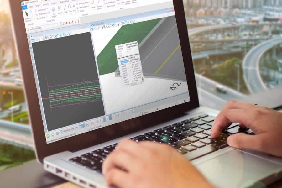
Use one application with comprehensive design, analysis, simulation, and construction documentation tools. OpenRoads Designer is the software of choice for infrastructure design. Design projects such as roadways, interchanges, roundabouts, water and sewer facilities, and land development, with ONE application. OpenRoads Designer includes everything you need for plan and construction documentation, surveying, stormwater design and analysis, visualization, geotechnical, underground utilities and so much more.
Data and Design Integration
 Data and Design Integration
 Easily work with data of all types and sizes
Create accurate, georeferenced 3D designs with real-world context through the seamless integration of reality data and design information. Work with all data types for less rework and simplified data collection and design within a model-centric plan that connects 3D models and 2D plans. Spend less time connecting the dots between data, disciplines, and teams and more time designing and delivering your civil infrastructure projects with software that does the collaborating for you, in one application.
Automatic Updates/Document Control

Reduce project risk and unnecessary rework
Automatic updates to models during plan production, reduces unnecessary rework and project risk. With a 3D model at the core of your design, every single change made to any element of your design will automatically replicate in other related components. Changing the slope of your embankment on the cross-section sheet will automatically update the 3D model. Lifting road elevation on a profile will increase earthwork quantities report etc.
Easy Coordination/Accelerated Approvals

Visualize projects in real-world context for informed decision making
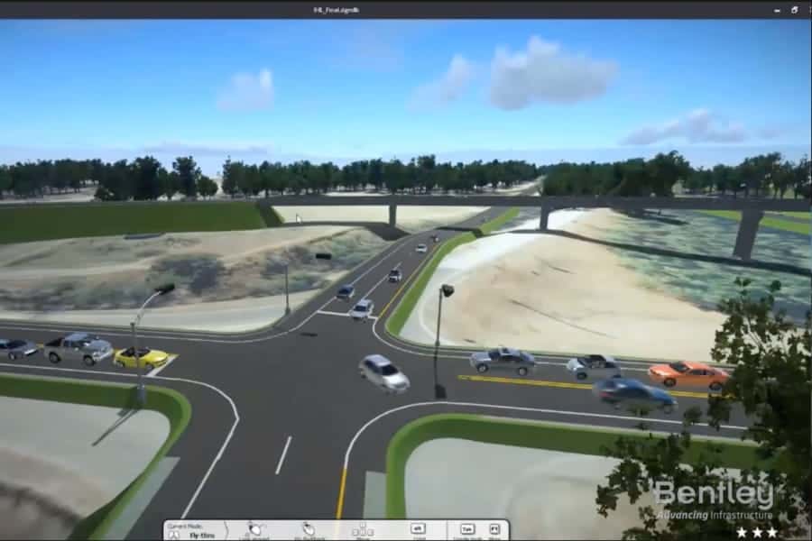
Reduce errors, omissions, and changes during construction thanks to the easy design, reviews, and approvals associated with a model-based project approach. Realistic visualizations help stakeholders make informed decisions quickly. 3D modeling and visualizations provide a detailed visual understanding of the design intent, allowing issues and conflicts to be detected among engineering disciplines saving money and time in the process.
Automated Drawing Production

Create 2D drawings directly from the 3D model
Simplify your workflows and reduce tedious manual rework by creating 2D drawings directly from the 3D model. Create plan profile sheets with fully customizable layouts and annotation. Reporting capabilities automate the production of a variety of standard and customizable reports, including horizontal and vertical alignments, quantity takeoffs, clearance reports and more. Quickly create cinematic visualizations for internal reviews, public review meetings or client briefs.
Customers like you choose OpenRoads
Joris Detrie, Team Manager, Integral Infrastructure Design at Sweco Nederland BV, said, “OpenRoads Designer enabled us to study and implement design changes fast within a very complex project, with swift impact analysis for all stakeholders. In this dynamic process, we created a common validated design, which strengthens the positive impact of the project on Antwerp and Flanders.”
For Foth Infrastructure & Environment, LLC’s, Senior Technology Manager Blaine Buenger the value is all about customer success. He added, “Using a BIM model, we reduced design time, modernized workflows, enabled the reuse of rich digital deliverables throughout the project lifecycle, and increased our ability to collaborate internally and with our stakeholders. All of these things increase our competitive advantage and allow us to deliver the highest level of service to our clients.”

OpenRoads e-book
From local streets to highways, designing, building, and maintaining roadways requires a team of skilled civil engineers, each of whom specializes in an individual aspect of the road and site project. To successfully deliver these projects on time and on budget, you need software that makes your job easier, not harder. That’s why we built OpenRoads Designer – all aspects of road design, in ONE application so you can easily meet project requirements on time, every time, regardless of change.
Read our free e-book today.