Liaoning Water Conservancy and Hydropower Survey and Design Research Institute Co., Ltd. / Dongtaizi Reservoir Project
Chifeng, china
Project
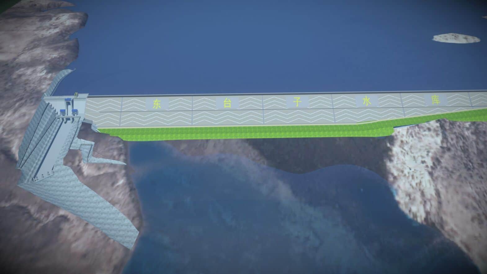
Liaoning Water Conservancy and Hydropower Survey and Design Research Institute was responsible for delivering the engineering design of the Dongtaizi Reservoir. This project is one of 172 major water conservancy endeavors meant to tackle China’s water scarcity and flood risk issues sponsored by the Chinese government. The proposed infrastructure is a rockfill dam with an asphalt core wall and a concrete gravity dam with a total storage capacity of 321 million cubic meters. Located in the upper and middle reaches of the Xar Moron River in Chifeng, Inner Mongolia, the reservoir will mitigate severe flood risk in the lower reaches of the river and supply water and agricultural irrigation to the areas adjacent to bottom of the river basin.
Facts
- The Dongtaizi Reservoir Project is one of 172 major water conservancy projects in China and one of 12 key livelihood projects in Inner Mongolia meant to mitigate severe flood risk and combat water scarcity.
- Complex terrain and infrastructure design required 3D modeling solutions to quantify structural elements and excavation amounts.
- Using BIM applications reduced design error by 90%, avoiding design changes and rework during construction.
“The use of Bentley software has solved the important and difficult problems in the engineering design of Dongtaizi Reservoir, provided strong endorsement for designers, improved the design efficiency of our institute, reduced design errors, and made the digital transfer of design results possible.”
– Wang Yixin, Director of the Digital and Smart Engineering R&D Center, Liaoning Water Conservancy and Hydropower Survey and Design Research Institute Co., Ltd.
Solution
After considering their options, the team employed Bentley’s BIM software for accurate 3D design. Liaoning Water integrated OpenBuildings and OpenRoads Designer to streamline collaboration among multiple engineering disciplines and to manage data. They surveyed the landscape and created a detailed 3D geological model to precisely calculate excavation volumes and plan excavation processes. This visualization in OpenRoads also allowed the project team to accurately position the ecological fishway and connect the structure’s complicated spatial curve to the landscape. The rockfill dam section was designed using OpenRoads’ linear engineering capabilities to generate a truthful 3D model incorporating all control and boundary conditions. Several engineering disciplines collaborated on the design of the concrete dam in OpenBuildings, allowing the hydraulic machinery, metal structure, and electromechanical equipment to be designed to avoid collisions.
Outcome
By using Bentley applications, Liaoning Water reduced design error by 90%. Delivering a technologically advanced model minimized changes to the overall design during construction. Accurately calculating project cost in the design stage of the project decreased the government’s overall investment. With the support of open modeling technology, the project team improved design efficiency by 40% to deliver the plans two weeks ahead of schedule. They leveraged BIM software to produce a digital twin that provides full lifecycle support of the dam, including management during construction, operations, and maintenance. Using this project as the foundation for BIM usage on future water conservancy projects, Liaoning Water has implemented corporate 3D collaborative design standards and trained personnel to become a regional leader in BIM application.
Software
OpenRoads
OpenRoads was used to successfully create a complex model of the dam excavation body, and at the same time get the back-filling quantities of excavation by analyzing earthwork from the original terrain and the excavated terrain. This was more intuitive, productive, and accurate compared with traditional 3D engineering.
OpenBuildings
OpenBuildings helped enable modeling of the concrete dam, as well as employ collision detection. In addition, OpenBuildings enabled quantity statistics of building elements and hydraulic components, eliminating the difficulty of accurate results faced in traditional engineering.