CAD Manager's guide to a smooth CAD transition with tips on determining the right software, transitioning to MicroStation, and preparing for change....
Architects, building designers, and interior designers need innovative CAD tools to produce high-quality drawings and 3D models for their building projects....
Do you have remaining budget? Are you wondering what to do for your end of year budget spending? This article will provide guidance on how to spend your end of year budget when you have remaining funds that need to...
There are many potential issues that can occur during the design phase of an infrastructure project that require changes including: Restoring changes at specific stages of the project life cycle Managing complex designs Tracking revisions Comparing changes between different versions...
AccuDraw is a remarkable MicroStation tool that boosts drawing productivity by tracking and anticipating the next drawing steps. The AccuDraw settings box appears on the MicroStation desktop when AccuDraw is active, and the AccuDraw compass appears on data points. The...
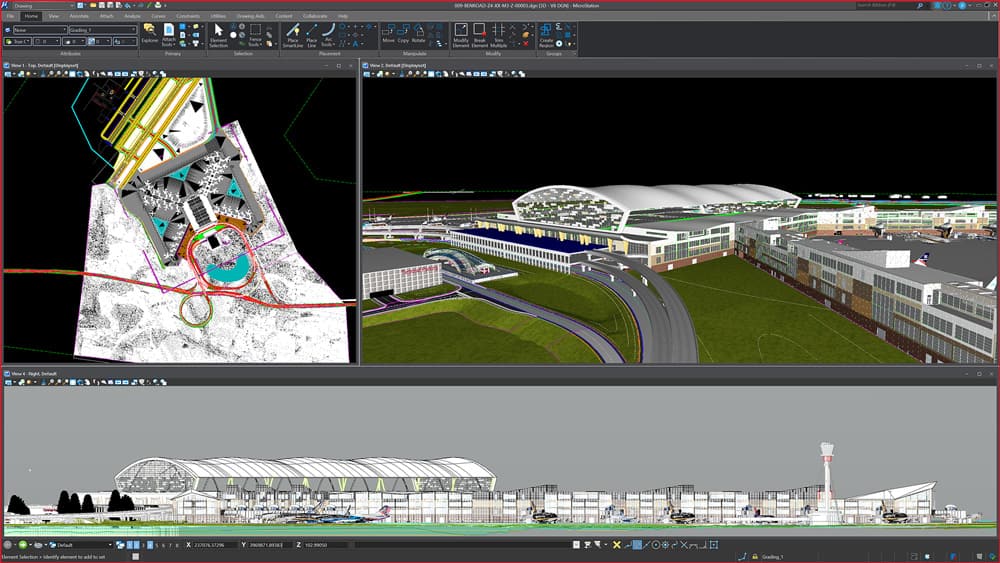
MicroStation 2023 is now launched and available for download! MicroStation 2023 is packed with new features, improved workflows, and several user experience enhancements, with focuses on a new access to geospatial features and maps, issue resolution improvements, increased data reporting,...